
CANARD by ITE
Inspections & Calibration
Drone-based inspections for visual aids, radio navigation systems and airport infrastructure.
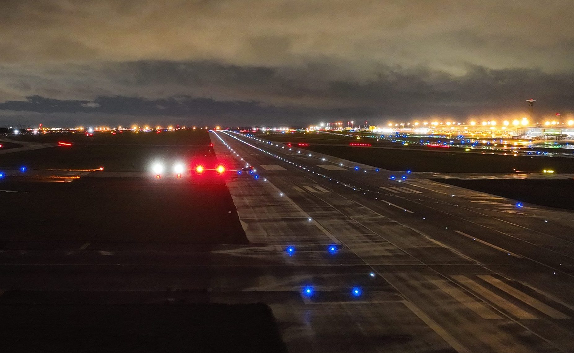
PAPI inspection · Light transitions observed from the approach
Visual aids
PAPI
Precision Approach Path Indicator
CANARD replaces conventional aircraft flight inspection for PAPI calibration by observing light transitions from controlled drone positions. The inspection supports commissioning, periodic checks and adjustment of individual units, with measurements available during the operation.
Commissioning · Periodic calibration · Adjustment
Measurements & checks
- Installation horizontality
- PAPI system angle
- Angular coverage
- Relative brightness
- Individual transition angles
- Transition width
- Left/right system symmetry
- Minimum Eye Height over Threshold (MEHT)
MEHT measurement requires an absolute height reference.
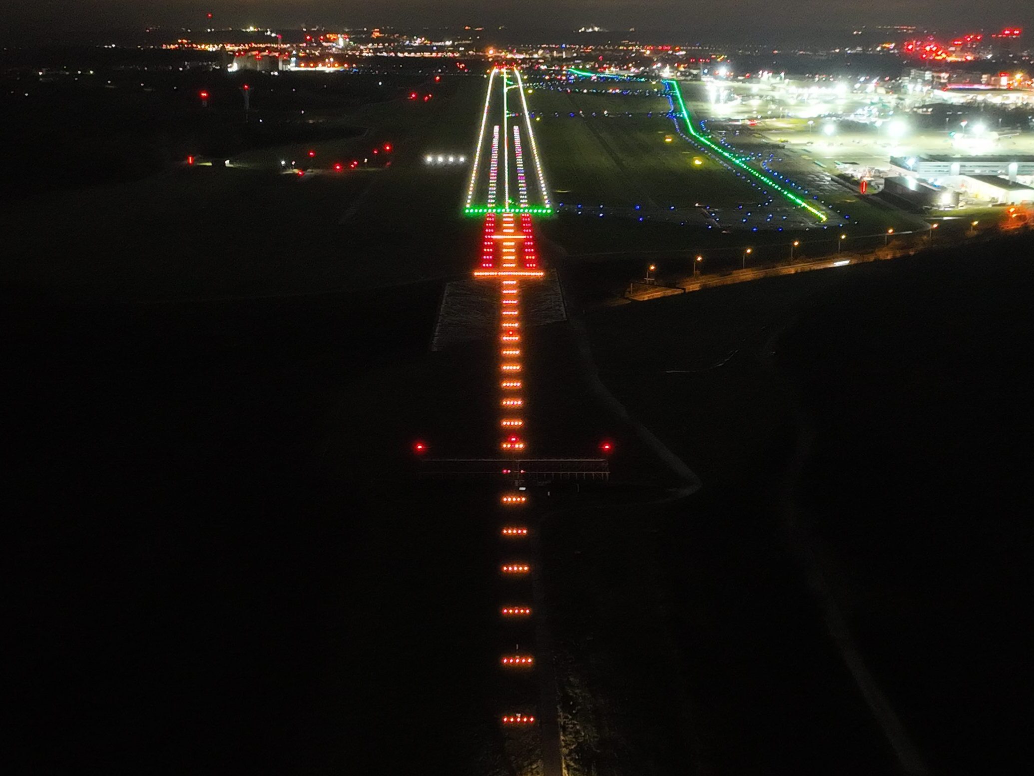
ALS inspection · Approach lighting geometry and visibility
Visual aids
ALS
Approach Lighting Systems
The drone provides an aerial view of the approach lighting system to verify its configuration, visibility and operation. Repeatable observations support commissioning, periodic inspections and checks following maintenance, including views on, above and below the approach slope.
Commissioning · Maintenance · Post-intervention checks
Measurements & checks
- Lights on/off
- Obstructions
- On-slope / high / low observations
- Relative brightness
- Light alignment
- Angular coverage
- Intensity settings
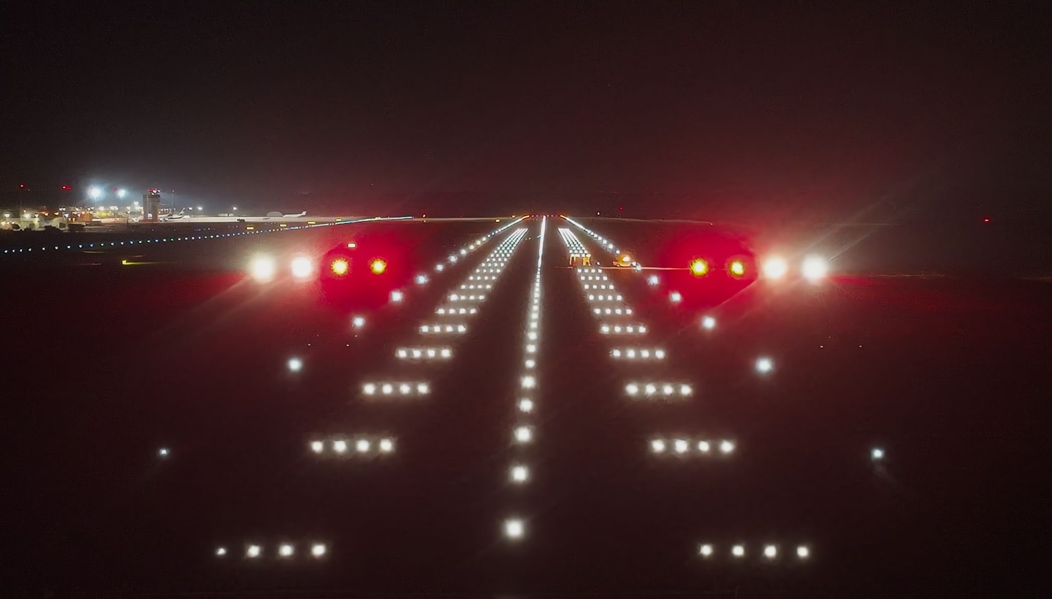
AGL inspection · Runway lighting viewed from the air
Visual aids
AGL
Airfield Ground Lighting
CANARD records runway and taxiway lighting from the air to support systematic maintenance checks. Images capture the operating condition of individual lights and the overall configuration, helping maintenance teams identify defects and review the response to different intensity settings.
Periodic inspections · Maintenance checks · Commissioning
Measurements & checks
- Runway and taxiway lights
- Threshold and runway-end lights
- Intensity settings
- Centreline and edge lights
- Lights on/off
- Relative brightness
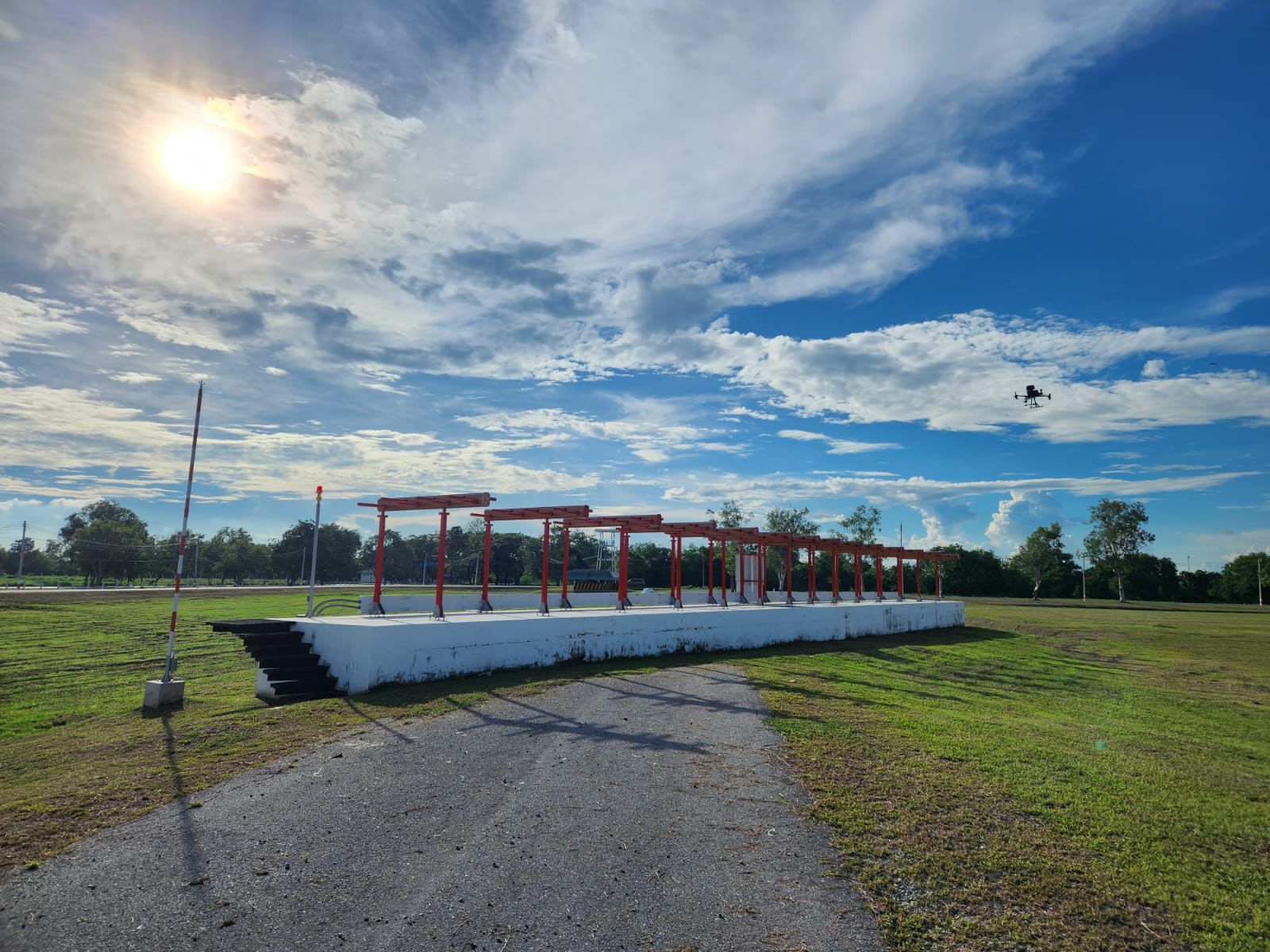
ILS enhanced ground checks · Localizer inspection
Radio aids
ILS
Instrument Landing System
Drone-based enhanced ground checks complement aircraft flight inspection by measuring localizer and glide path signals along dedicated flight profiles. They support maintenance and troubleshooting and can help reduce aircraft inspection frequency or flying time within the applicable maintenance programme.
Enhanced ground checks · Troubleshooting · Pre-flight adjustment
Pre-commissioning adjustment
Repeated measurements support preliminary alignment and adjustment before the aircraft inspection campaign, particularly during commissioning and at sites with complex signal environments.
Measurements & checks
- LOC/GP displacement sensitivity
- LOC/GP alarms
- LOC/GP structure
- Glide path angle
- LOC/GP width
- LOC/GP clearance
- Localizer course alignment
- Identification
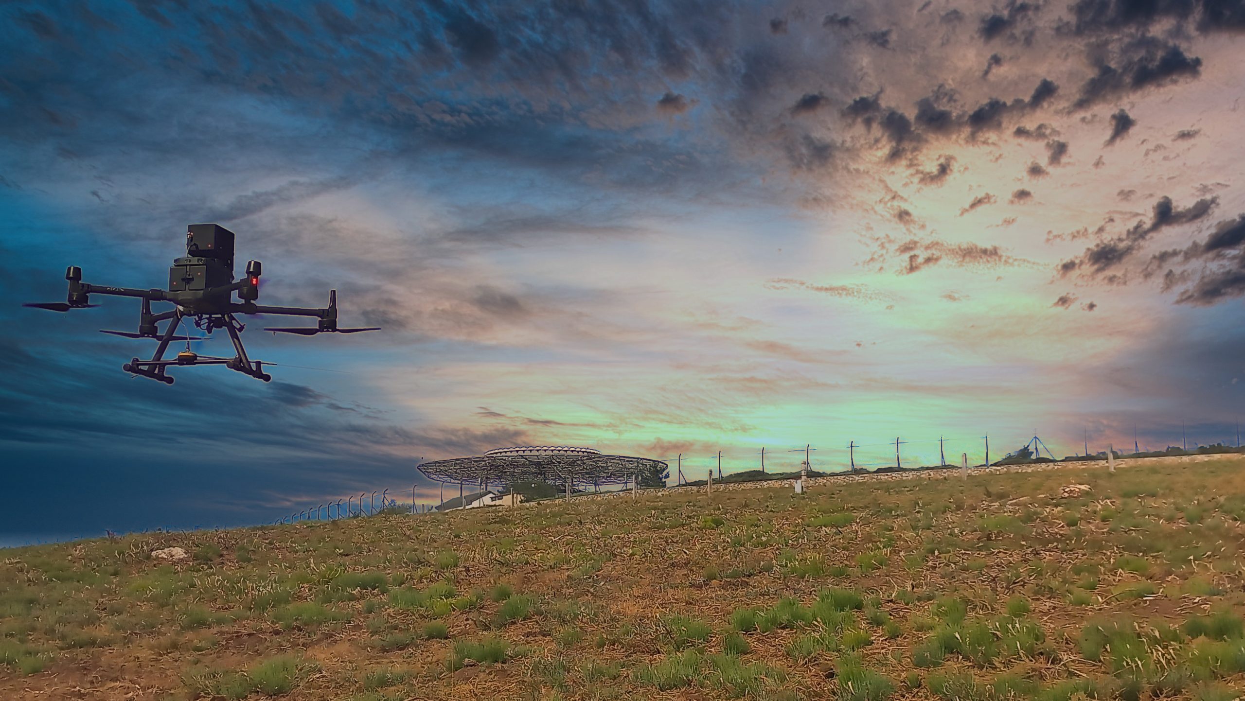
VOR enhanced ground checks · Drone measurements around the station
Radio aids
VOR
VHF Omnidirectional Range
Enhanced ground checks on repeatable radial and orbital flights complement aircraft inspection. They support fault investigation, interference analysis and preliminary adjustment before commissioning. Within the applicable maintenance programme, they can reduce the frequency or flying time of aircraft inspection campaigns.
Enhanced ground checks · Fault investigation · Commissioning support
Measurements & checks
- Bearing error
- 9960 Hz modulation depth and frequency
- FM ratio
- Radial and orbit analysis
- 30 Hz modulation depth and frequency
- FM deviation
- Identification
- Cone of silence check
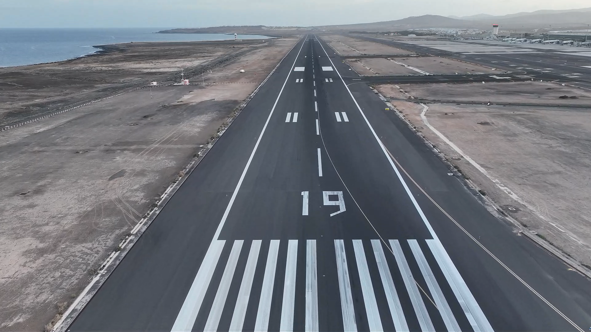
Runway markings · Aerial inspection of painted surfaces
Airport infrastructure
Runway Markings
Visual condition and maintenance review
Systematic aerial imagery provides a record of runway markings for condition review and maintenance planning. The drone captures markings from a consistent perspective so that wear, discontinuities and areas requiring closer review can be documented and located.
Condition surveys · Maintenance planning · Repainting preparation
Inspection capabilities
- Presence and continuity
- Position and geometry review
- Maintenance findings
- Visible wear and deterioration
- Georeferenced imagery
- Photographic evidence
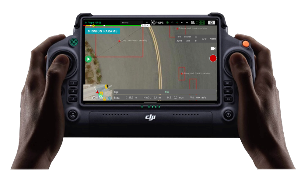
CANARD app · Pavement distress identification
Airport infrastructure
PCI
Pavement Condition Index assessment support
The drone captures pavement imagery along planned routes. CANARD processes the images into georeferenced inspection records, allowing defects to be marked and reviewed. AI-assisted detection supports the technical assessment, while validated findings form a damage inventory for PCI evaluation.
Pavement surveys · Distress inventories · Maintenance planning
Inspection capabilities
- Systematic pavement image capture
- Distress detection and marking
- Damage inventory
- Georeferenced inspection imagery
- Affected-area delineation
- Technical review and validation
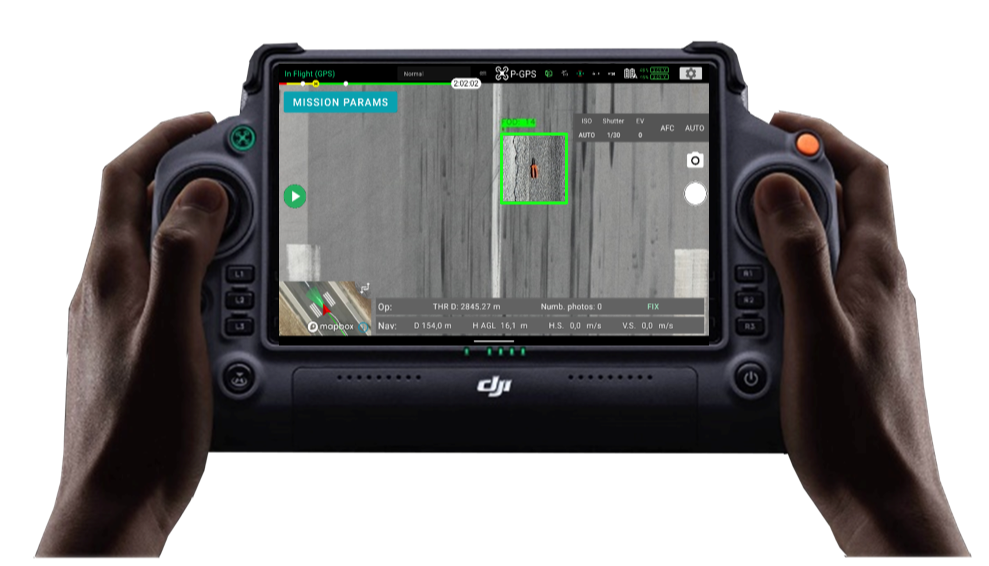
CANARD app · FOD detection with image evidence
Airport infrastructure
FOD
Foreign Object Debris detection
CANARD analyses drone imagery to identify possible foreign objects on airport surfaces. Geolocated findings and image evidence allow maintenance teams to review detections and locate objects for removal. Inspection routes can be divided into shorter tasks to fit operational windows.
Surface inspections · Object detection · Maintenance response
Inspection capabilities
- AI-assisted object detection
- Image evidence
- Review of detected objects
- Geolocated findings
- Operator validation
- Information for maintenance teams
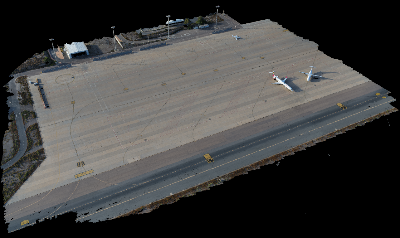
eTOD survey · Three-dimensional airport reconstruction
Airport infrastructure
eTOD
Electronic Terrain and Obstacle Data
Drone surveys capture georeferenced information about airport terrain and surrounding obstacles. The resulting imagery and survey data support mapping, obstacle inventories and assessment of the airport environment, with the survey scope defined for each project.
Terrain surveys · Obstacle inventories · Airport environment mapping
Inspection capabilities
- Georeferenced survey data
- Obstacle positions and heights
- Cartographic representation
- Terrain elevation information
- Obstacle inventory
- Data for obstacle assessment